Today we take a trip to Cherokee and the Great Smoky Mountain National Park via a narrow two lane windy (is there any other kind in the mountains here?) road that on the passenger side is very very close to the mountain to the right.

Speed here is 45 miles per hour but with the curves going one way and then another, it is hard to keep that rate.


The forest is so dense and at times shade covers the entire roadway.

This is a very big tourist area with lots and lots of motels, cabins, and campgrounds and lots of tourist shops. One thing you do not see are large RV's, such as ours, on the roadway (can't imagine why not), but lots of small trailers.
The town of Cherokee is a town given over to the Cherokee Indian culture with museums, shops, etc. It being Sunday, only the tourist shops, outlet malls and restaurants were open so we were unable to learn more about the Cherokee and the Trail of Tears so proceeded through town and into the mountains.
What we did learn was that the Cherokee described these mountains as "shaconage" meaning blue, like smoke. Here they farmed the land, built log homes and tried to adapt to the European newcomers who were encroaching on their land. Today Eastern Cherokees who are not descendants of those forced to leave on the Trail of Tears live on a reservation next to the national park.
Congress authorized this Park in 1926 but it was not established until 1934 and was established through the use of private lands. The Park is divided between Tennessee and North Carolina and the Newfound Gap Road bisects the Park and is 53 miles long and 18 miles wide. In the Park are more tree species than in northern Europe, 1500 flowering plants, dozens of native fish and over 200 species of birds and 60 of mammals. Wow! Most of the park is managed as wilderness and when you see all the foliage and the mountains which seem to go on forever, it is no wonder.
We stopped at the Oconaluftee Visitor Center at the start of the Park road and enjoyed learning more about the development of the Park, the people who lived in the area at the time and taking in the Oconaluftee Mountain Farm Museum behind the Visitor Center.

Further along the road, we stop at the Mingus Mill

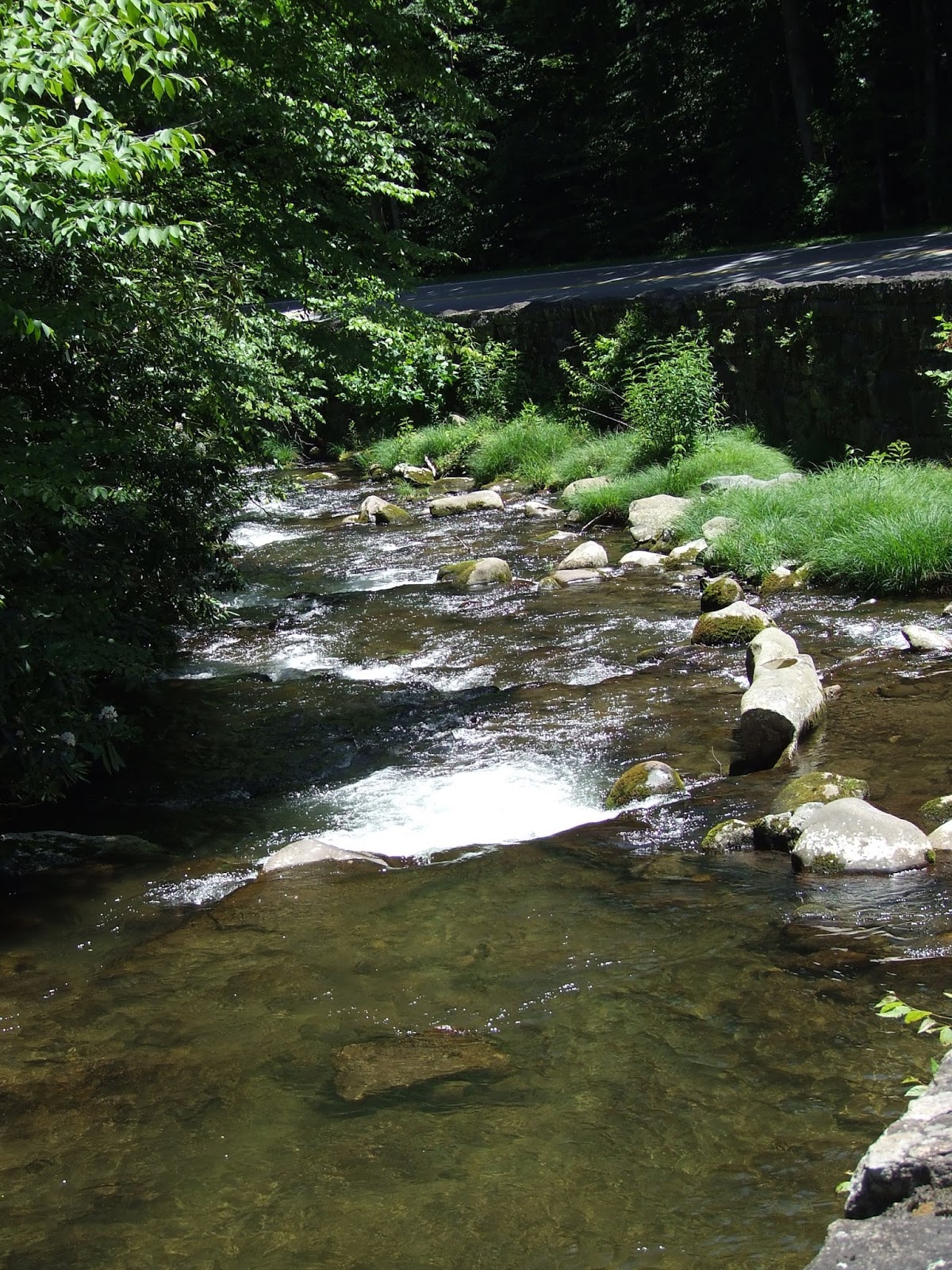
The road runs along the Oconaluftee River for quite a distance but looks more like a creek compared to the Mississippi and Tennessee Rivers which we have seen recently. However, it is swiftly moving water as it moves down the mountains and over the rocks making for a tranquil scene.

Arriving at the dividing line (actually the Appalachian Trail) between North Carolina and Tennessee, we find a place to park and take a few pictures from the view points. You will notice from the picture below why we do not usually go to tourist areas on Saturday and Sunday.


Returning the way we came, we stop in Cherokee for a late lunch and have an opportunity to sample a local dessert - a sweet potato wrapped in filo dough. It looks like a pig in a blanket. We have seen whole pies with sweet potato filling but have not yet had a chance to sample this. As to the " potato in a blanket", we would pass next time.

We turn off at the Southern Entrance to the Blue Ridge Parkway following it for several miles to the turnoff to Maggie Valley which takes us back the way we started this morning. When we return to Waynesboro, VA in another week, we plan to take the last part of the Parkway (the Northern End) which leads into the Shenandoah National Park.


No comments:
Post a Comment