Monday, August 1,
2016
We have been on the road for two months today and have seen
so much and so many different landscapes from arid lands to forests to lakes
and mountains and historic cities and buildings. Today we leave Kalispell for a week in Helena , MT
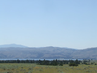
Our drive is along the east side of Flathead Lake
We had no ideaMontana had so many lakes and rivers. The roads are all quite smooth but some
narrower than others. The road seems to
be windy as we follow the shorelines of the various lakes.
We had no idea
Stop for a lunch break along this lake.
We drive through forested areas for a while and cross the Continental Divide as we nearHelena where we find the
mountains with less trees and very dry grasses.
This area seems to be more cattle grazing.
There is a fire danger alert on our weather station for the area and I can see why. Hopefully, we will see no fires though several are raging to the west and south of this area.
We drive through forested areas for a while and cross the Continental Divide as we near
There is a fire danger alert on our weather station for the area and I can see why. Hopefully, we will see no fires though several are raging to the west and south of this area.
Tuesday, August 2,
2016
In 1864 four weary and discouraged southern prospectors
stumbled upon a gulch and dubbed it “Last Chance Gulch” (the original name of
the city) only to find gold. This touched
off the establishment of Helena as the “Queen
City of the Rockies ”
which became the state capital in 1889.
The gold rush faded out quickly and Helena became a trade center for the
surrounding goldfields.
Drive through downtown today to get some literature from the Visitor Center
We take off on I-15 north to see the Gates of the Mountain
which is located on Holter Lake created by the damming of the Missouri
River which empties into this area. It is at this Dam site (see picture below)
that Meriwether Lewis camped (now under water) in July of 1805. Boat rides are available to take you to see
the limestone cliffs punctuated with small holes, caves and natural
bridges. The mouth of this area is just
visible in the second photo below.
Leaving the Lake, we backtrack a bit to take the road to the
town of Canyon Ferry and drive south along Canyon Ferry
Lake
This lake too was created by damming theMissouri River as well but farther south
from the Holter Dam. The lake is
stocked with rainbow trout which grow quickly because of the lakes
fertility. The road takes us through a
largely farming area with campgrounds located along the way. Off and on we get views of the lake as along
this largely deserted roadway. Arrive in
the community of Townsend at the far end of the Lake where we turn back north
to Helena .
This lake too was created by damming the


No comments:
Post a Comment