Tuesday, July 4, 2017

Fort Vancouver National Historic Site

Sunday, July 2, 2017
  
Today we traveled west on Highway 14 (remember this highway runs right along the Columbia River) stopping at two little towns on our way to Washougal, Camas and Vancouver.  Camas is the home of a very large Georgia Pacific Paper Mill which takes up several blocks.  A cute town with some old buildings.    
Flower found in Park in Washougal

Above pictures from downtown historic Camas
Arriving in the Vancouver area we sought out the old Fort Vancouver National Historic Site located on a beautiful well groomed 300+ grassy acres.  Fort Vancouver was an important Hudson's Bay Company fur trading post that was established in 1824.  The U.S. Army in 1849 constructed the Vancouver Barracks next to the trading post and later took over the facility when it was abandoned.  A fire destroyed the fort in 1866 but the Army continued to operate in various forms until the present time.  The Fort was separated from the Army Barracks and became a National Monument in 1948.  In 1966 at the urging of the local community, construction began on all the modern replica fort structures which were placed on the original locations seen today.  


Parade Grounds


Hospital

Officers Row


Now a restaurant


Monday, July 3, 2017

Learning More History of the Area

Saturday, July 1, 2017

Today we ventured into the town of Carson, just a short distance west of our campground and up into the hills a bit.  A small town with a very large sawmill and lots and lots of logs piled up waiting to be processed.  What an avalanche there would be if these logs started to roll down.

Found this interesting tree along one of the street and later learned from friends that it is actually a redwood.  At one time, experimental seedling trees were planted by employees of the mill and there are many other such trees in this area.  This tree is actually two trees planted close together and now appear to be one. 

Also found an interesting, junky antique shop to explore where I found of all things, material to purchase.  Good price for some material I can use to make charity quilts.

From here we explored Stevenson taking a few pictures here and there before heading further west toward the Bonneville Dam and Lock.  A sign which said Fort Cascade Trail caught our attention so we sidetracked to explore.  This a little over a mile trail along the River with sign posts and a brochure lets you experience sights, events and people who helped settle and develop the Pacific Northwest.  While there are no buildings left, the information is very descriptive and gives one a real feel for the area in that time period. 
In 1894 the river flooded removing soil and Fort Cascade and exposing the huge rocks that you now see along the trail shown in the pictures above.  Notice too the lichen growing on the rocks.

This petroglyph rock with meaning unknown serves as a reminder of the people who once lived here.


Further on we came across the area where the Blacksmith shop was located with this old wheel reminding us of just what blacksmiths did during that early time.

The entire walk was not only beautiful and serene, but educational and a reminder of the people and events which took place in this area.  These beautiful flowers growing along the trail just added to our enjoyment.

From here we continued down the same road to the Bonneville Dam and Lock Visitor Center.   Lake Bonneville is a 48 miles long reservoir impounded by the dam and the first in a series of navigable lakes which are part of the Columbia-Snake Inland waterway running 465 miles from the Pacific Ocean to Lewiston, Idaho.  It was built and is operated by the U.S. Army Corps of Engineers and was the first Federal lock and dam on the Columbia and Snake Rivers.  Construction began in 1933 and was dedicated in 1937.  The present  lock completed in 1993 reduced lockage time to less than 30 minutes with lockage available 24 hours a day.  We did not see the lock as the present lock is located on the Washington side.  However, we toured the building above the dam viewing the waterways below.

One of the most interesting things we saw was the Fish Ladders.  Fish Ladders?  Yes, fish ladders.  The ladders are passageways for adult fish that seasonally migrate upstream.  Pools in the fish ladders form a cross barrier that forms steps, set in a ramp leading up and around the dam.  The cross barriers have openings along the bottom to allow the fish to swim easily from one stairstep to the next.  Very interesting to observe.  If you look closely at the last picture below, you can see a few fish. 


An interesting and educational day for us.


Sunday, July 2, 2017

Boating on the Columbia

Friday, June 30, 2017

Our drive today was to find the tunnels on Highway 14 along the Columbia River in Oregon.  When making the reservation at our campground, the host told me to be sure to drive west on the Oregon side, cross over the Bridge of the Gods and turn back east for the campground on the Washington side. 

Being the curious guy Ron is, we drive down the road to see what it is all about.  There is a semi that goes through one of the tunnels as well as several cars towing trailers and 5th wheels.  However, it is a bit unnerving as a couple of them decide their half is in the middle.  That is because the tunnels are not just the highest in the middle but rather some are one height on one side and the other side is either taller or shorter.   For us to go through this tunnel in the RV we would have to be further to the left since we are nearly 13 feet tall and since this is a two way highway, it would be a bit scary.
Note the height on the right side


Driving further east we proceed across “The Dalles” which is a wider and longer bridge than some of the others.   Here at The Dalles there is one of the many dams and locks along this river. 


The Dalles Bridge 


We drive around this fair size city and find a few interesting sites. 


Old Masonic Lodge now a restaurant

Further west from The Dalles is the “Hood River Bridge” which would have been the one we crossed with the motor home if it were not so narrow and allowed RV’s and trucks.  Looking at the picture, you can see why we didn’t.  It is also a rather long bridge.  


Hood River Bridge


Both this Bridge as well as the Bridge of the Gods are toll bridges and cost $2.00 to cross.  Those who live here purchase tickets as it is very common to cross these bridges several times in one day.   We stopped at a park along the river watching a barge pushing a large load down river. 


Our evening entertainment and meal is aboard the Columbia Gorge, a sternwheeler that provides sightseeing trips and dinner cruises along the Columbia River leaving from the town of Cascade Locks in Oregon.  


We board our boat and are assigned to a table next to a window near the front of the boat.  The dining room is not totally full so everyone had a table near a window. 


Dining Room on the Boat
Our waitress immediately takes our drink order and from there our meal begins, even before we leave the dock.  The captain speaks a few words and from there proceeds to get us under way.  This is Ron and my anniversary dinner and gift to ourselves.  We have several choices for our dinner as well as being able to purchase drinks and appetizers, if we wish. 

During the trip, the captain from time to time gives us some history about the river and history of the area.  

The wind has come up before we board so the trip up river has the wind behind us, but we are warned that when we turn back down river, we will have the wind in our faces so hang on tight if we are outdoors.  He wasn’t kidding.  The day has been quite warm at mid 80’s and our evening cruise (beginning at 6 p.m.) is still very warm and pleasant in spite of the wind.  


A view of the shoreline


The road above I-84 is the old highway now a bike and walking path


Indian fishing docks along the river

A sea lion enjoying the evening light
We see a number of sail boats, some wind surfers and some kite surfers (surfers using large kits to propel them through the water).  This kite surfing was new from our last visit here in 2006.  There are also a couple of barges being pushed down river. 


Turning back south, we proceed as far as the Bonneville Dam and Lock 

Looking toward the Bonneville Lock
before we again turn back toward Cascade Locks and the wharf.  

Headed  home looking toward the Bridge of the Gods
A wonderful evening, good meal and a nice way to celebrate our anniversary.

A view we see all along the highways - Mt. Hood

Saturday, July 1, 2017

Moving into Washington State

Thursday, June 29, 2017
  
Today we left behind the RV Park in Redmond where RV’s had been arriving the past couple of days for a dog show this weekend.  We could not believe it when a small RV pulling a small camper trailer pulled in in front of us.  That was interesting in itself, but when dog after dog after dog kept coming out of the RV (a total of 10), we were flabbergasted.  Not only 10 dogs but 6 of them standard poodles and the other four probably standard poodle puppies about 6 months old.  The couple set up numerous wire cages and put two standard poodles in each and one with the four puppies.  Amazing.  Not sure I would like traveling with that many dogs in any size RV.  One was enough when we had Trixie.


Our travel north into Washington was beautiful.  Lots of views of the snow capped mountains, a beautiful river alongside in places, lots of lush green forest and the closer we came to the Columbia River, lots and lots of orchards.  Not sure what kind of fruit, but I would guess probably apples as I know they grow lots of apples in Washington


The bad part of the drive is that it is mostly all two lane highway though there are many, many passing lanes along the way.  Highway 97, 26 and 35 are all heavily traveled roads not only for cars, but semis as well as RVs of all sorts.  Trying to come onto the highway is any of the towns along the way without a stop light is a long wait because vehicles are spaced together so closely. 


We had quite an argument with “Mildred” our GPS today about whether we should be on any of the roads.  I had done my research in the truck atlas to make sure we could travel all of the roads and was assured by it that we could.  However, Mildred said we were too long and too heavy.  She was especially distressed when we crossed the Bridge of the Gods in Cascade Locks, OR over the Columbia River into Washington.  We forged on ignoring her whinning and crossed this narrow bridge without incident. 


We had to go west in Oregon on I-84 (the highway runs along the beautiful Columbia River and mountains making it a most enjoyable drive) to go back east in Washington to our campground as there are four low tunnels just east of where we are staying.  While the truck atlas says we can clear it and apparently semis do it, the campground and my old roommate said “don’t try it”, just go west and then back east on the Washington side.  It’s safer.
 
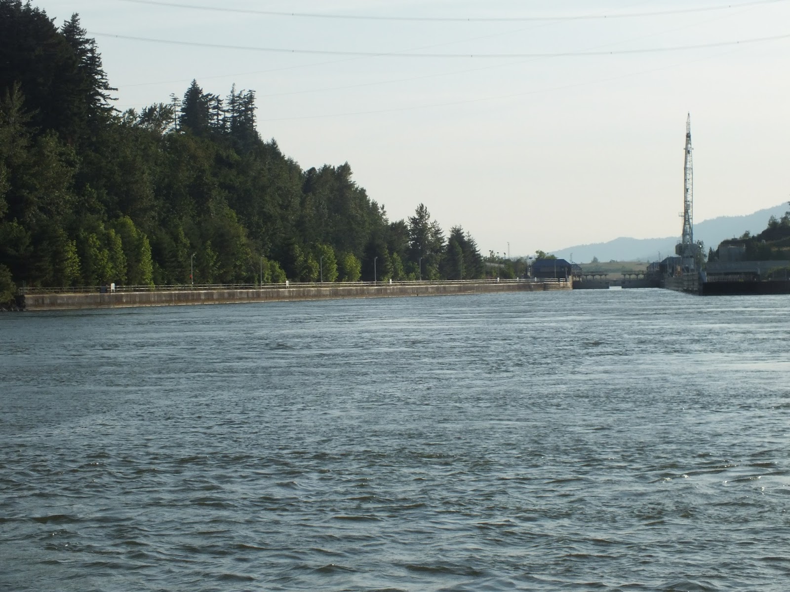
Looking from I-84 across the Columbia to Washington
Arriving in Washington, we drove along the narrow highway along the river toward our RV Park located away from the hustle and bustle of life and into a serene and peaceful spot in the mountains among the trees.  This serene spot will be our location for the next week. 


Met the neighbors next door who also own a Tiffin Phaeton like ours.  We compared notes on problems, etc.  Not only are they from Texas but own a casita at the RV Park in Kerrville where we were last year and will be again this year.  As well, they are acquainted with the couple who were located next to us at the Park last year.  Small world.  Who says you have to live in the same place all the time to make friends or meet people who know who you know.  We plan to see them again this fall when we arrive in Texas.